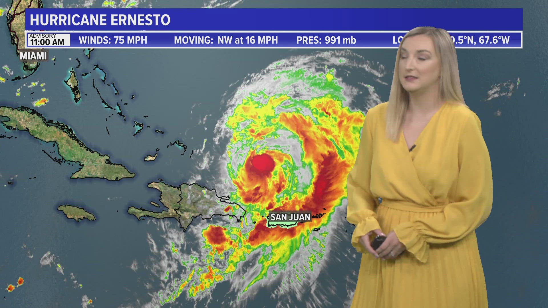
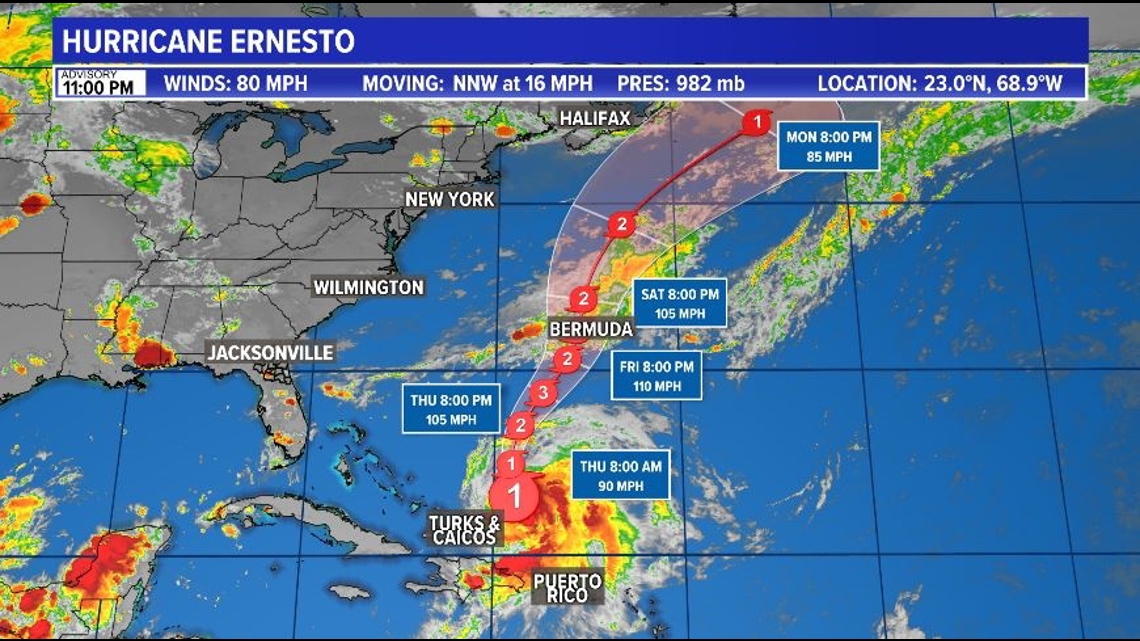
JACKSONVILLE, Fla. — Ernesto continues to strengthen in the Atlantic Ocean. Those with interests in the eastern Caribbean and Bermuda should continue to monitor it.

Even as Ernesto pulls away from Puerto Rico, the hurricane is still bringing heavy rains to Puerto Rico, creating the risk of flash flooding and mudslides.
Ernesto is expected to continue to strengthen. It could be a Cat 2 by Thursday night and a Major Cat 3 by Friday.
It will then continue to move north and approach Bermuda. The forecast currently calls for it to drop in intensity to a Cat 2 before impacting Bermuda.
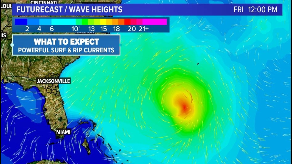
Although Ernesto is expected to stay at least over 800 miles away of Jacksonville, by Friday, a powerful surf and rip currents will be likely at the beaches. However, it will also reinforce dry, more comfortable air over our area Friday.

- Current Position: Around 950 miles southeast of the First Coast, 265 miles NW of San Juan, Puerto Rico, and 765 miles SSW of Bermuda.
- Current Strength: Hurricane with winds of 80 mph
- Model Guidance and Potential Path: Gradual strengthening as it moves north over the Atlantic, heading towards Bermuda
- Tropical Alerts: A Hurricane Watch is in effect for Bermuda
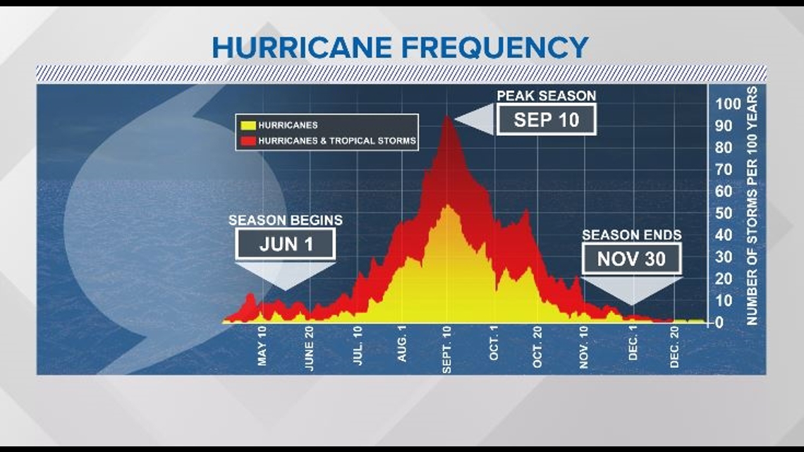
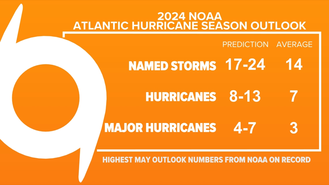
NOAA updated their Atlantic Hurricane season outlook. The forecast continues to call for an above average hurricane season as sea surface temperatures remain warm and a La Nina remains in place. The Atlantic waters are at record warm levels; as hot as what is typical for September. That is why our hurricane season is running about two months ahead of schedule.

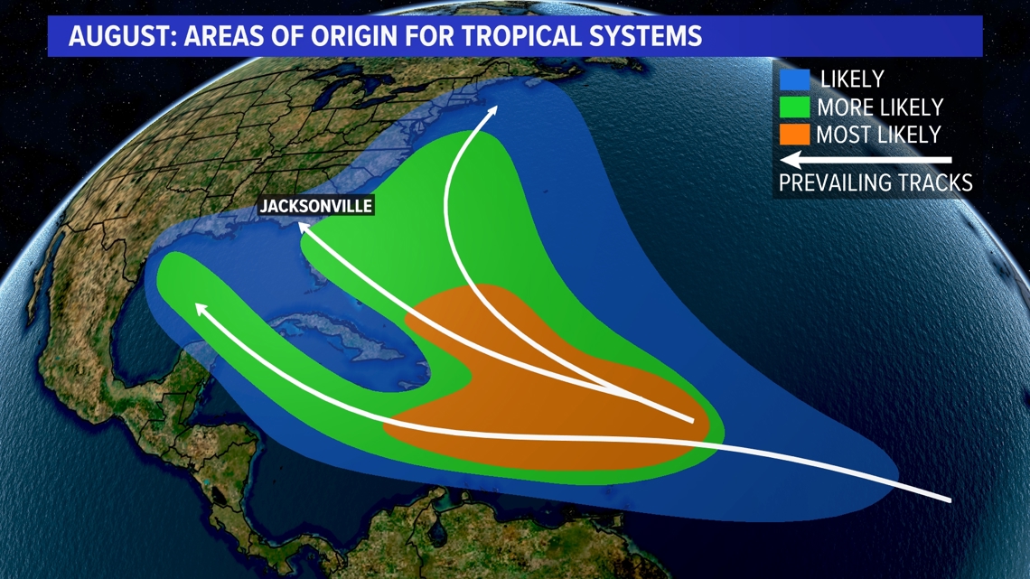
In August, the most likely place for tropical systems to develop are over the eastern Caribbean, but they can develop anywhere.